


Amarnath in Kashmir draws pilgrims to the high Himalayas, where the Holy Cave of Shri Amarnathji sits at 3,888 metres. The trek goes through mountains and valleys, giving a spiritual experience in the heart of Kashmir.
You can get to the cave from Pahalgam or Baltal. Each route has a different distance, terrain, and timing, so the Amarnath trek distance depends on which path you choose and where you begin.
This guide covers the Amarnath yatra trek distance for both routes, their difficulty, the cave’s height, key details for 2026, and tips to help you get ready.
What Is the Amarnath Yatra Trek, and Who Is It For?
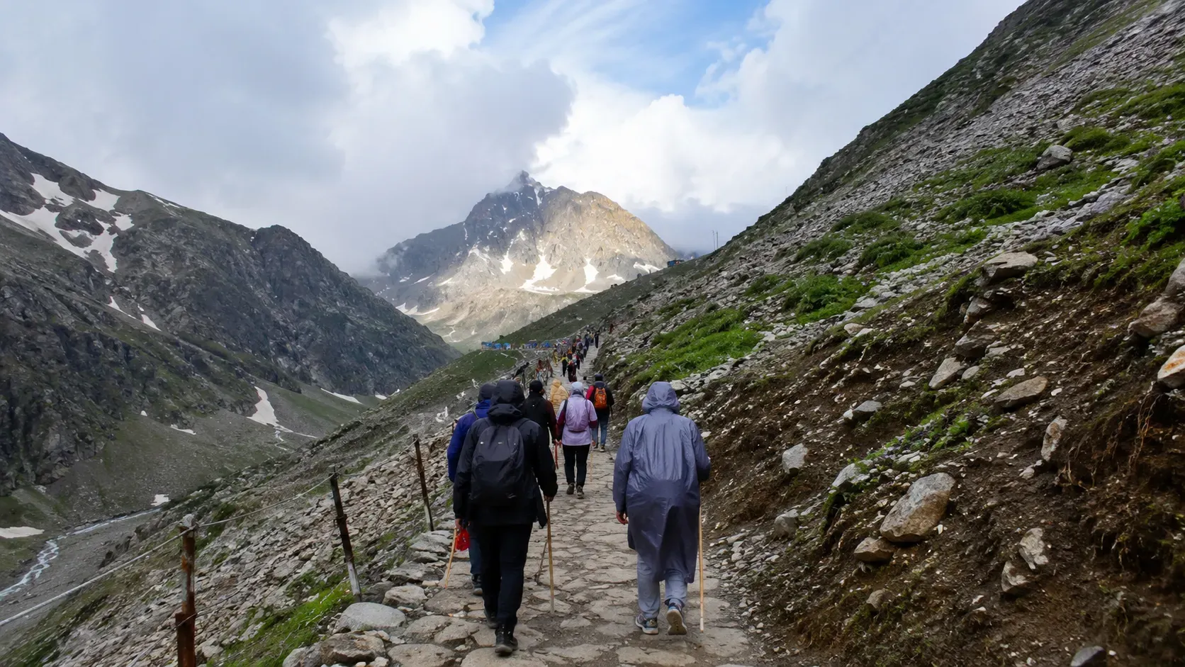
The Amarnath Yatra trek is an annual pilgrimage administered by the Shri Amarnathji Shrine Board (SASB). In 2026, the yatra runs from 3 July to 28 August, a 57-day window aligned with the Hindu sacred month of Shravan.
Registration is mandatory for all pilgrims, without exception. The daily cap is 20,000 pilgrims across both routes combined, 10,000 per route. Slots fill within days of registration opening. In 2026, registration opened on 15 April on the official Shri Amarnathji Shrine Board website for Rs. 150 per pilgrim. A Compulsory Health Certificate from an authorised doctor is required at the time of registration. Every registered pilgrim also carries an RFID card during the Amarnath trek.
The Amarnath trek distance at high altitude means it is no casual walk. It is a pilgrimage through a demanding Himalayan environment. Pilgrims of all ages are eligible, provided they are medically fit and cleared by a doctor.
Detail | 2026 Facts |
Yatra Dates | 3 July to 28 August 2026 (57 days) |
Daily Pilgrim Cap | 20,000 total (10,000 per route) |
Registration Fee | Rs. 150 per pilgrim |
Official Portal | jksasb.nic.in |
Health Certificate | Compulsory, from an authorised doctor |
RFID Card | Mandatory for all pilgrims on both routes |
Which Route Is Shorter: Pahalgam or Baltal?
The Amarnath Yatra trek distance differs significantly between the two main routes. Knowing the Amarnath Yatra trek distance before you register helps you plan your schedule, rest days, and training. Your route choice affects how many days you need, how hard the trek will be, and your overall experience. Here’s a quick comparison before we get into the details.
Route overview at a glance:
- Pahalgam Route: 46 to 48 km one way | 4 to 5 days | Moderate difficulty
- Baltal Route: 14 km one way | 1 day (same-day return) | Difficult to strenuous
The Pahalgam to Amarnath trek distance is over three times longer than the Baltal route. But the Baltal route is much steeper, while the Pahalgam route spreads the climb out over several days.
Pahalgam Route: A Longer Trek Through the Himalayas
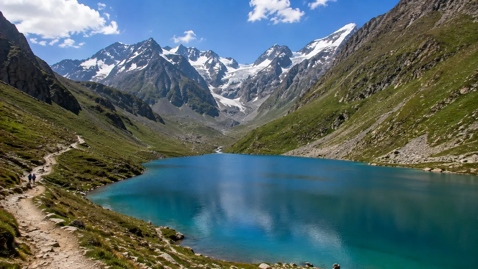
The Pahalgam to Amarnath trek distance is about 46 to 48 km one way from the Pahalgam base camp to the holy cave. This longer, traditional route is the most popular choice for first-time pilgrims.
This route takes several days, which helps your body adjust to the higher altitude:
- Day 1: Pahalgam base camp to Chandanwari (12 km)
- Day 2: Chandanwari to Sheshnag via Pissu Top (11 km)
- Day 3: Sheshnag to Panchtarni, crossing Mahagunas Pass (13 km)
- Day 4: Panchtarni to the holy cave and darshan (6 km), then return
Pahalgam is 115 km from Srinagar and 265 km from Jammu by road. Most pilgrims reach the base camp by road before covering the Amarnath trek distance on foot.
You can hire ponies and palkis (doli carriers) along this route. Helicopter services also run from Pahalgam to Panchtarni, which reduces the Pahalgam to Amarnath trek distance; from there, you only need to walk about 6 km to the cave.
Stage | Location | Altitude | Distance | Day |
Base Camp | Pahalgam | 2,130 m | Start | Day 1 start |
Stage 1 | Chandanwari | 2,895 m | 12 km | Day 1 end |
Stage 2 | Sheshnag (via Pissu Top) | 3,590 m | 11 km | Day 2 end |
Stage 3 | Panchtarni (via Mahagunas Pass) | 3,657 m | 13 km | Day 3 end |
Stage 4 | Holy Cave (Amarnath) | 3,888 m | 6 km | Day 4 |
Baltal Route: A Shorter Trail with Steeper Sections
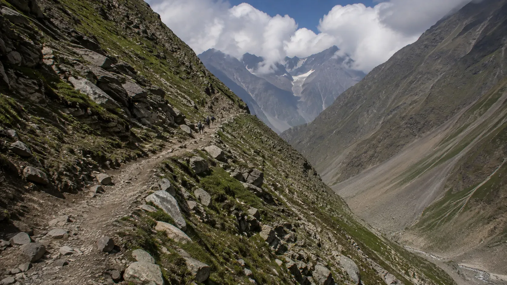
The Baltal to Amarnath trek is about 14 km one way from the Baltal base camp to the holy cave. This route is shorter but much steeper and more challenging than the Pahalgam route.
Baltal base camp sits at 2,743 metres. The climb up to the cave at 3,888 metres is steep, with narrow paths, river crossings, and rocky sections. Fit pilgrims usually start at 4:00 AM, reach the cave by noon, and return to Baltal by 8:00 PM the same day.
Key facts about the Baltal to Amarnath trek:
- Ascent takes 5 to 7 hours; descent takes 3 to 4 hours
- Ponies are very limited or unavailable on this route
- Helicopter service operates from Neelgrath (Baltal) to Panchtarni, from which the cave is 6 km on foot
- The Baltal to Amarnath trek covers an Amarnath trek distance of 14 km one way and is completed in a single day with no overnight stay required.
Stage | Location | Altitude | Distance | Trek Time |
Base Camp | Baltal | 2,743 m | Start | 4:00 AM departure |
Midpoint | Domel | 3,050 m | 4 km | Approx. 2 hrs |
Upper stretch | Sangam | 3,488 m | 8 km | Approx. 4-5 hrs |
Destination | Holy Cave (Amarnath) | 3,888 m | 14 km | Approx. 5-7 hrs |
How Difficult Is the Amarnath Trek?
Know the Amarnath trek difficulty level before you register. Both routes lead to the same cave, but each has its own physical challenges.
The Pahalgam route is seen as moderate. The climb is gradual and spread over several days, which helps your body adjust to the altitude. It’s a good choice for first-time pilgrims, older adults, and people who don’t trek often. Taking extra days helps at this altitude.
The Baltal route is considered difficult to strenuous. You climb all the way up in one day, which makes the Amarnath trek difficulty level much tougher. This route is best for people who are very fit and have experience trekking at high altitudes.
No matter which route you choose, the Amarnath trek distance takes you above 3,800 metres on the Amarnath Yatra trek, where there is less oxygen and every kilometre feels harder. If you don’t acclimatise or push yourself too much, you could get altitude sickness.
Route | Distance | Duration | Difficulty | Best For | Ponies |
Pahalgam | 46-48 km | 4-5 days | Moderate | First-timers, families, older pilgrims | Yes, available |
Baltal | 14 km | 1 day | Difficult to strenuous | Fit adults with trekking experience | Very limited |
How High Is the Amarnath Cave?
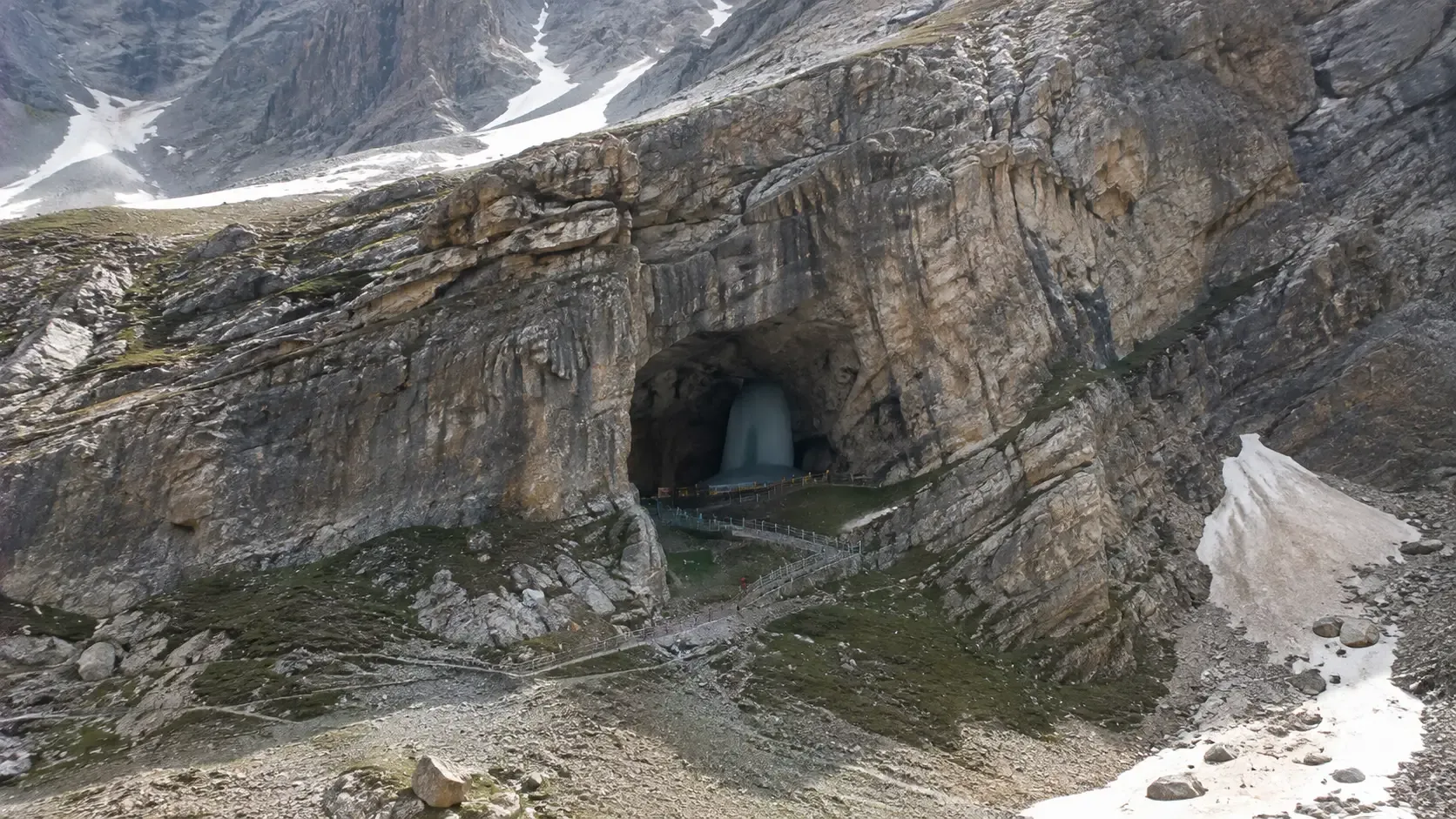
The Amarnath trek height reaches 3,888 metres (12,756 feet) above sea level at the holy cave. Keep this official altitude in mind when planning your trek.
At the Amarnath trek height, there is much less oxygen than at sea level. Even walking slowly can feel tiring. Breathlessness, headaches, and dizziness are common signs of altitude sickness, especially if you haven’t acclimatised.
Inside the cave, the main attraction is the naturally formed ice Shivling. The cave is big enough for groups, and SASB officials and security staff organise darshan in queues. The Amarnath trek may feel long, but the experience inside is peaceful and well managed. Because of the high altitude and the Amarnath trek distance, temperatures can drop below freezing even in July and August. Sudden snow or rain can happen on either route. Always pack warm clothes and a rain jacket, no matter what the weather is like when you leave the base camp.
Altitude profile across the Pahalgam route:
Location | Altitude |
Sea Level (reference) | 0 m |
Pahalgam Base Camp | 2,130 m |
Chandanwari | 2,895 m |
Sheshnag | 3,657 m |
Panchtarni | 3,657 m |
Amarnath Cave (summit) | 3,888 m |
What Do You Need Before Starting the Amarnath Yatra?
Every pilgrim on the Amarnath yatra trek must complete mandatory registration at the official website of Shri Amarnathji Shrine Board before setting foot on either route. No one may take the Pahalgam route or the Baltal to Amarnath trek without a valid yatra permit and RFID card. This applies to every pilgrim, including those using helicopter services.
A Compulsory Health Certificate from an authorised doctor is required at registration. This is non-negotiable and confirms you are medically fit for the high-altitude Amarnath trek.
Getting physically ready is important. Start training at least 4 to 6 weeks before you take on the Amarnath trek distance of your choice. Long walks, climbing stairs, and light jogging will help you build the stamina you need.
At the Amarnath trek height of 3,888 metres, even experienced trekkers need to acclimatise. Don’t skip spending a night at the base camp before starting your ascent.
Pre-trek checklist:
- Registration: Complete at the official website; carry permit at all times
- RFID card: Issued at registration; mandatory on both routes
- Health certificate: From an authorised doctor; compulsory at registration
- Physical training: Begin 4 to 6 weeks ahead; focus on stamina and cardiovascular fitness
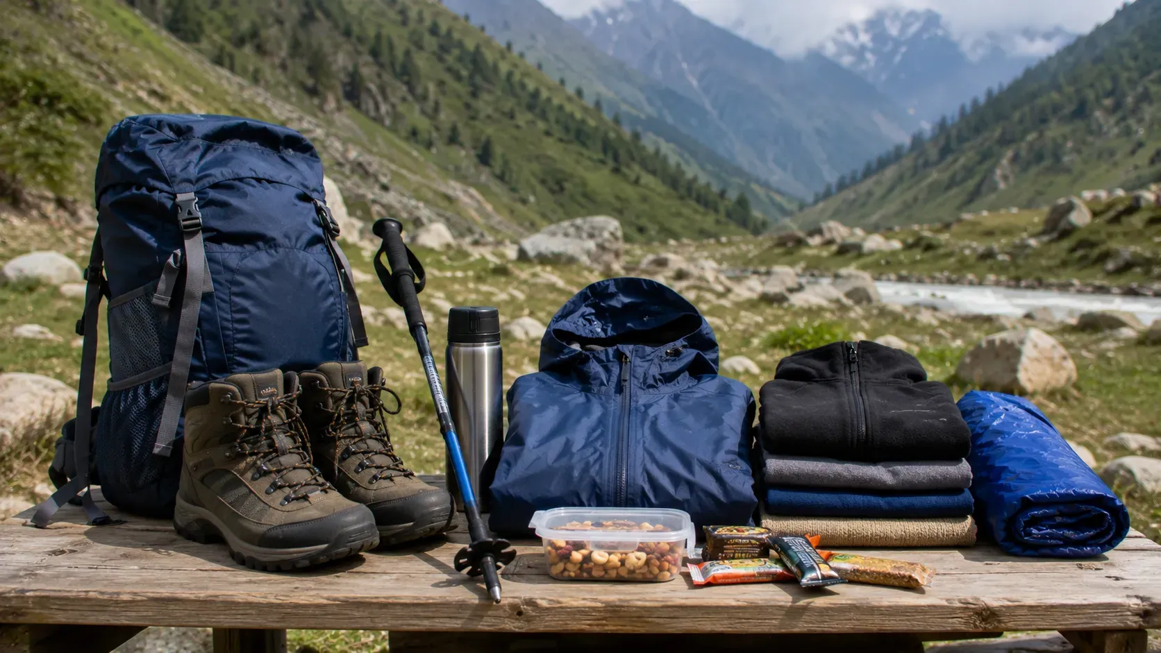
- Gear: Waterproof jacket, warm layers, ankle-support trekking shoes, walking stick or pole
- Supplies: Water, electrolytes, energy snacks, altitude sickness medication (consult your doctor first)
- Acclimatisation: Spend at least one night at the base camp before starting the trek; do not rush the ascent
Final Takeaway
There isn’t just one Amarnath trek distance. It’s 46 to 48 km from Pahalgam over 4 to 5 days, or 14 km from Baltal in one steep day. Since the Amarnath trek reaches a height of 3,888 metres at the holy cave, you need to prepare physically for either route. The Amarnath trek difficulty level at the Baltal route is much tougher than the Pahalgam route. The 2026 Amarnath Yatra trek runs from 3 July to 28 August, and you must register with SASB.
If you need help planning your holiday to Kashmir, Holiday Tribe can create a custom plan that fits your needs and schedule.